Do you know which routes in your community have been designated as components of the Primary Highway Freight Network? How many people are living in the CDC-identified high health risk zone adjacent to those routes? How will additional routes in urban areas be added?
If you or your organization have made comments, please let us know.
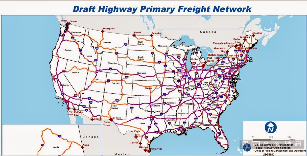
The Department of Transportation’s Federal Highway Administration is extending again, from Jan. 17 to Feb. 15, the period for public comments on its draft initial designation of the highway primary freight network. The PFN is part of the National Freight Network that the Moving Ahead for Progress in the 21st Century Act (MAP-21) directed the DOT to establish to assist states in strategically directing resources toward improved system performance for the efficient movement of freight on the highway portion of the U.S. freight transportation system. MAP-21 limits the highway PFN to not more than 27,000 centerline miles of existing roadways that are most critical to the movement of freight.
The five areas in which the FHWA is seeking comment are (1) specific route deletions, additions or modifications, (2) the methodology for achieving a 27,000-mile final designation, (3) how the NFN and its components could be used by freight stakeholders in the future, (4) how the NFN may fit into a multimodal National Freight System, and (5) suggestions for an urban area route designation process.
The complete FHWA notice is here.